
Quail West
Unparalleled Efficiency
- Completed By Deadline
- Development Size
- PRICE (BASED OFF INDUSTRY STANDARD)
Location: Village of Estero, FL
Duration: February 2018 – November 2018
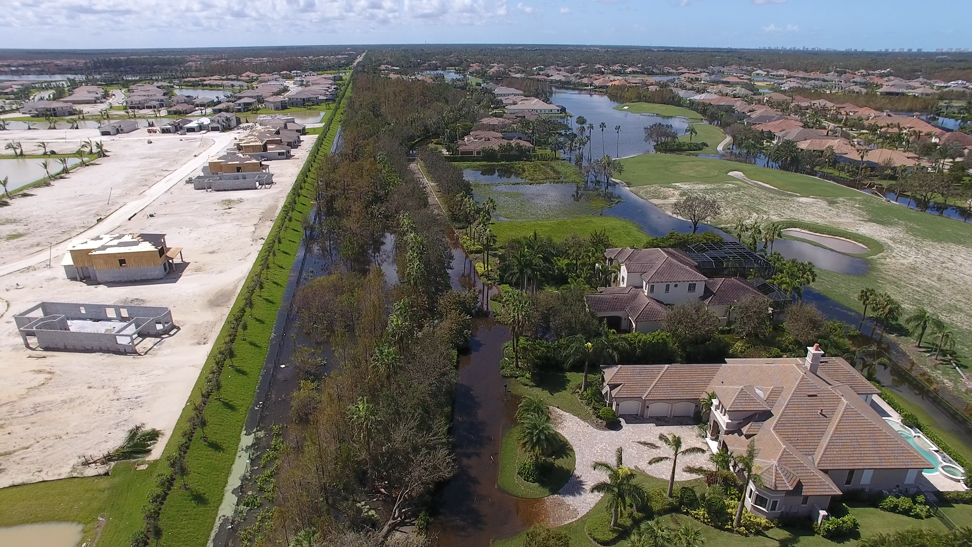
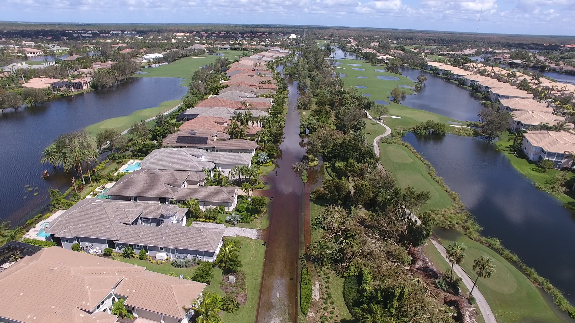
The model was calibrated using the NEXRAD rainfall data specific to the project area from August 20th, 2017 to September 20th, 2017, during which time the storm events INVEST 92L and Hurricane Irma occurred. Drone video and aerial photography taken between September 12th and September 14th, 2017 were used to estimate peak stages in each of the twenty-three (23) sub-basins. Adjustments were made to several parameters during the calibration process until peak model stages were consistent with the observed peak stages.
Once the ICPR4 Model was calibrated, the JR Evans Engineering team analyzed the results of each sub-basin and lake interconnect within the system to evaluate potential problem areas in the community. Problem areas were identified by reviewing the calibrated model results and noting where large differences in peak stages of adjacent sub-basins occurred and where incoming flows were much greater than outgoing flows in a sub-basin. Problem areas were also identified during the data collection phase when documenting the observed peak stages throughout the development’s sub-basins.
The JR Evans Engineering team determined fourteen (14) improvement projects that would prove beneficial to the community when implemented. The improvement projects were determined using an iterative process and with cost in mind, resulting in the greatest benefit to the community without unjustified costs. Implementation methods and potential impacts of the improvement projects were also considered to limit the disruption to the golf course, traffic/residential roadways and existing homes. The project included preparing map exhibits of the proposed improvements, cost estimates and permitting requirements for the implementation of the improvement projects.
Previous Project
Village of Estero Stormwater Master Plan
Description: The Village of Estero hired the JR Evans Engineering team to prepare a specific Stormwater Master Plan for The Village with the objective of creating a detailed and calibrated model of the Village's stormwater infrastructure to be utilized in…View All Projects
Explore Our Recent Projects
J.R. Evans Engineering has a team of experts who offer decades of experience in providing unparalleled solutions to complicated projects. Our professionals always seek to cultivate and maintain long term relationships with our clients.